Just a few taps and you've got a hill for the weekend.

Every Munro, Corbett, Graham, Wainwright and Hewitt

Never done one? Start here.

A bit about me
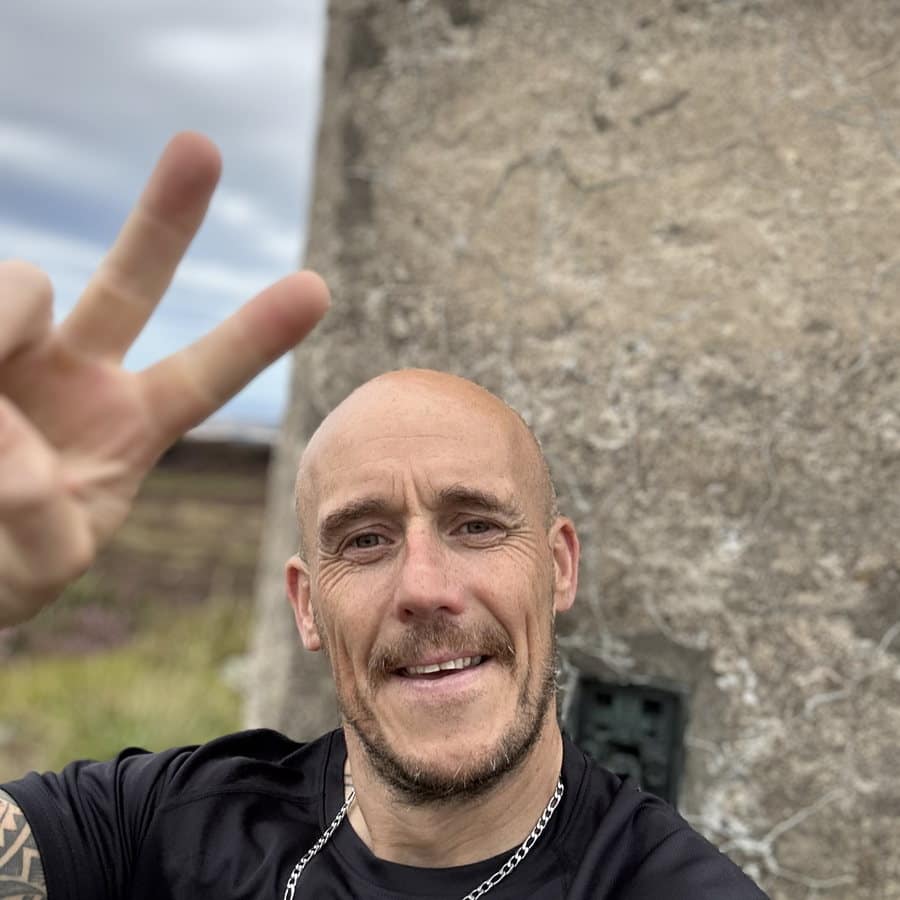
Ross at the trig point on Meikle Balloch Hill

I'm Ross. I live in Moray, and I've always loved walking.

The walks were put on hold due to life getting in the way of things. I'm getting back into it now, and the hardest part hasn't been the walking — it's been deciding where to go. So I built an app to make that bit easier.

I've done a few Munros in the past. This time I'm building up to them gradually and ticking off the hills close to home first — Ben Aigan, Knock Hill, the Bin of Cullen, plus a few more.

I called it Climb A Munro because Munro is the word everybody knows — say Corbett or Graham to most people and you get a blank look. The app itself covers far more than that: 1,374 summits across the five lists, 282 of them Munros, and the local hills on top of that.

It's by no means an app that tells you how to climb a hill — that bit's on you. But if you're curious like me and want to get out and explore, it's a grand place to start.

This site is the journey. Where I've been, what it was like, and whatever I work out along the way.

The round

Every hill in the app, one at a time.

The aim is to walk up all 1,391 of them. It'll take a while. This is where I keep score.

Hills walked

11of 1,391

1,380 to go.

Munros

2 of 282

280 to go.

Corbetts

1 of 223

222 to go.

Grahams

2 of 228

226 to go.

Local hills

6 of 17

11 to go.

Walked so far
  1. Morven Aberdeenshire · 872 m
  2. Clachnaben Aberdeenshire · 589 m
  3. The Buck Tomintoul to Banff · 721 m
  4. Bennachie (Mither Tap) Aberdeenshire · 528 m
  5. Tap o' Noth Aberdeenshire · 563 m
  6. Ben Aigan Moray · 471 m
  7. Bin of Cullen Moray · 320 m
  8. Knock Hill Aberdeenshire · 430 m
  9. Meikle Balloch Hill Moray · 366 m
  10. Carn Ghluasaid Glen Affric to Glen Moriston · 956 m
  11. Sron a' Choire Ghairbh Loch Arkaig to Glen Moriston · 936 m
Try it right now

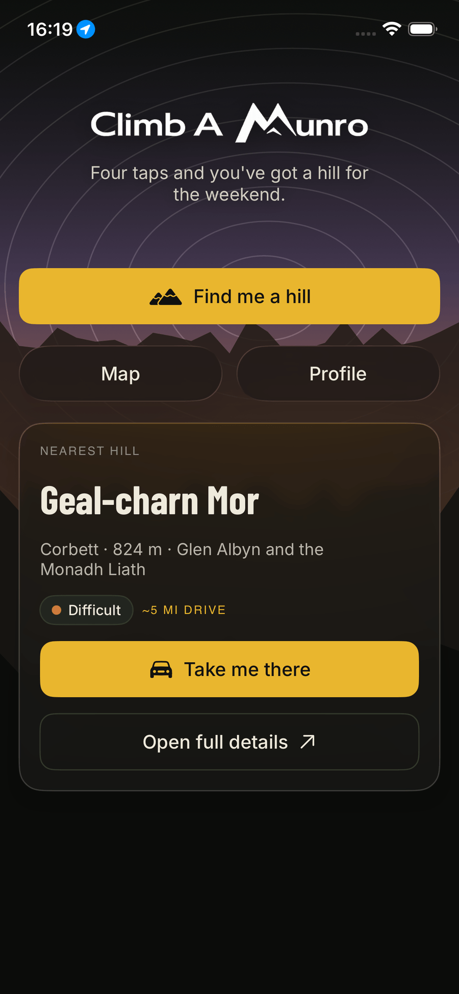
What's the nearest hill to you?

Same maths the app runs — press the button, we ask your browser where you are, and show the closest of 1,391 summits. Nothing is stored, nothing leaves this tab.

📍

Give the browser permission and we'll find the closest hill in about a second.

What it does

Not sure where to start?

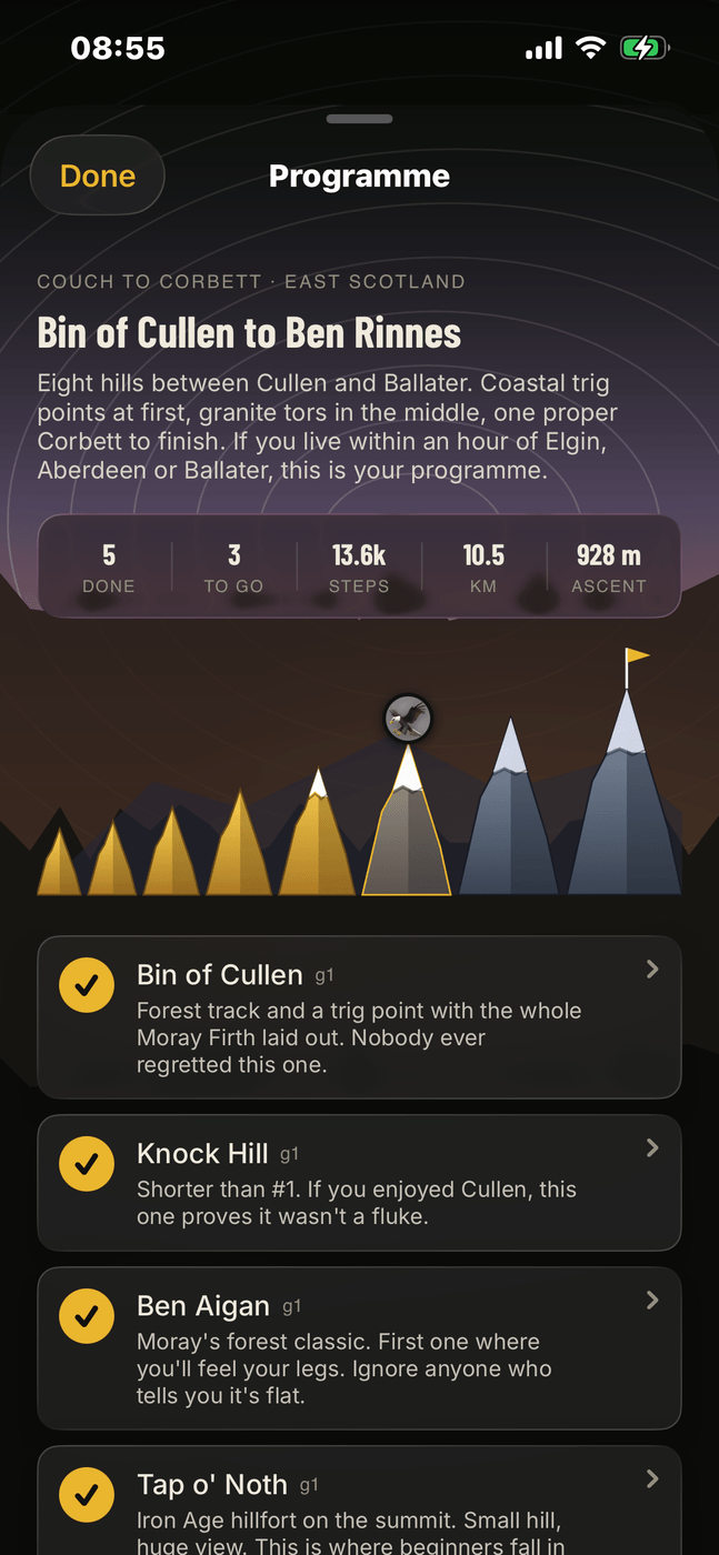
Couch to Corbett lays out eight hills in order for your part of the country, starting with something small and finishing on a Corbett. Ten regions to pick from, and a badge for each hill as you go. By the end of it you'll have a fair idea whether you fancy a Munro.

Read the beginner's guide

Never heard of half of them?

A terrain map of 1,391 summits across Britain and Ireland, each with a description written for the app. If a hill involves a scramble or needs navigation, it says so, so you know what you're in for before you set off. There are small local hills in there too, for anyone wanting a short day before they take on something bigger.

Make it count.

Private GPS tracking, a gold star for each summit and a running tally of your round. Your walks stay on your phone, with no ads and nothing watching where you go. Signing in is only needed for syncing across devices or using Baggers.

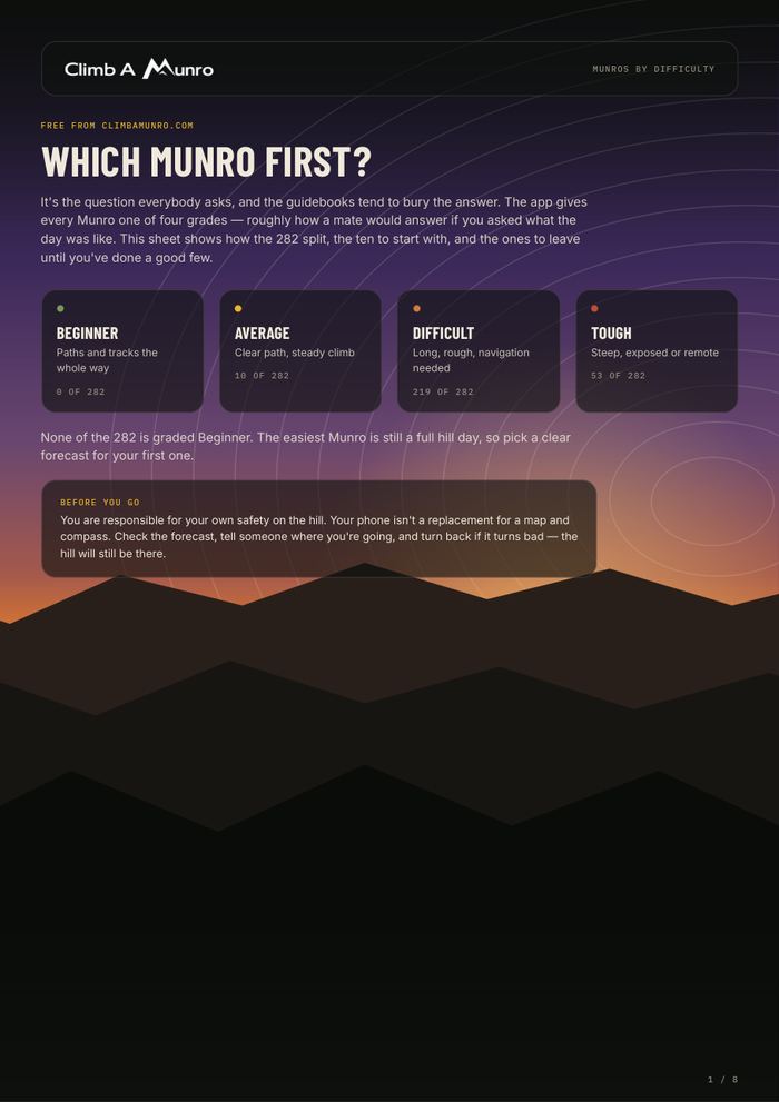
Honest grades

Four words. Real days.

No stars or numbers, and nothing described as "moderately challenging". Every hill in the app gets one of these four, which is roughly how a mate would answer if you asked what it was like.

Beginner

Paths and tracks the whole way

Average

Clear path, steady climb

Difficult

Long, rough, navigation needed

Tough

Steep, exposed or remote

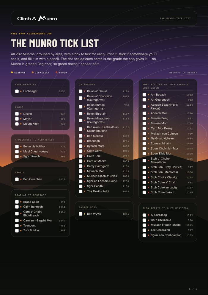
The lists

1,374 summits, five lists.

Hillwalking here runs on lists and nobody really explains them. Here's what each one is.

What's in the app

Built for a cold hand and a bright day.

Couch to Corbett

Eight hills, building up to a Corbett.

Pick a region and it lays out eight hills in order — a coastal trig point or a forest track to start with, a proper Corbett at the end. Ten regions, so there's a programme wherever you are. A badge for each hill as you tick it off, and the next one is sitting there on the screen when you finish the last.

Find a hill

A few taps. One hill.

Pick Munro or hill, pick your level, say where you are and how far you'll drive. It shows you every hill within reach, sorted by nearest or easiest, with a plain-English write-up for each one.

Everything on one screen

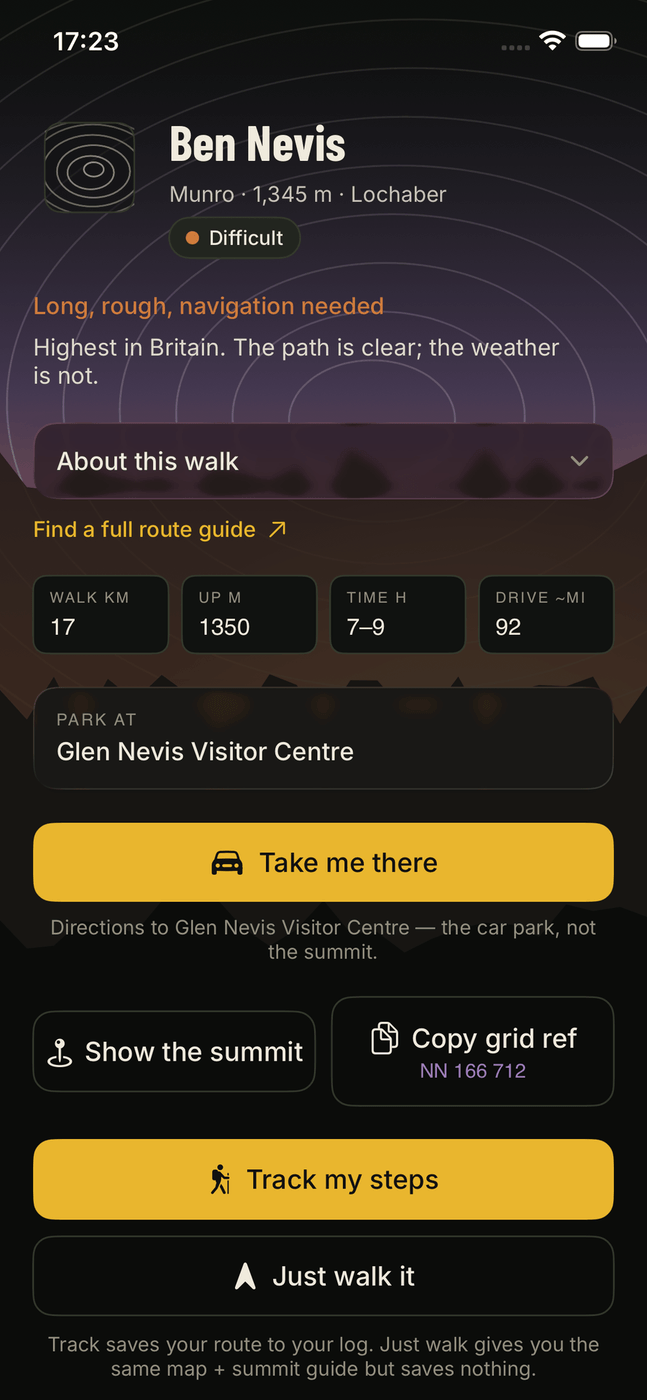
The write-up you'd actually read.

An original description of the walk, an honest grade, the OS grid reference, and a car park with one-tap directions. There's a tick to mark it as one you've already done, so nothing gets missed off your log.

Track — or just walk it

A hero countdown, not a stopwatch.

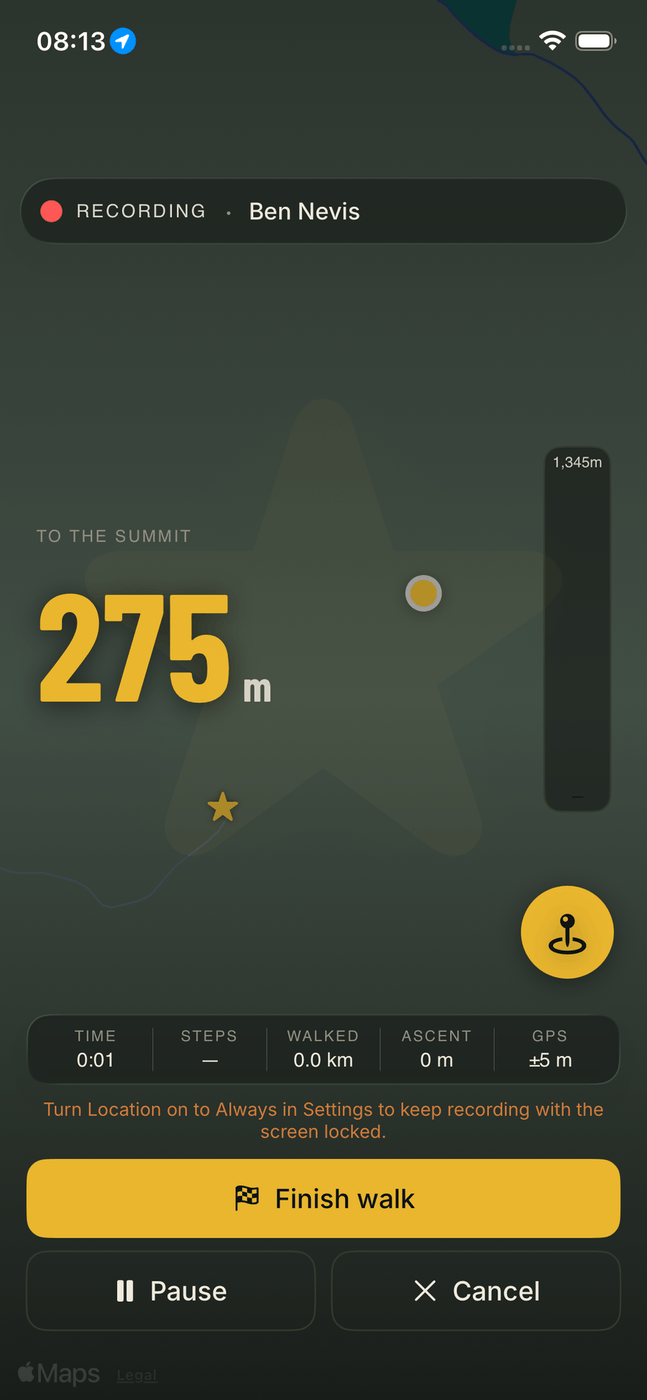
A big number counting down the metres left to the summit, which is usually the only figure you care about on a long day. The ascent gauge fills as you climb and a gold star appears inside the last 500 m. There are two modes: Track saves the walk to your log, and Just walk it gives you the same map and countdown without saving anything.

Recording · Ben Nevis
To the summit
340 m
3:24· 4.8 km· 820 m
Finish walk
Notes as you go

Drop a pin. Say a thing.

Tap the + as you walk and it pins a note at your exact spot. "Boggy bit", "cairn hidden left", "good lunch spot". You can add as many as you like and read them back on the walk afterwards, and they go with the route if you share it with your Baggers.

Already been up a few?

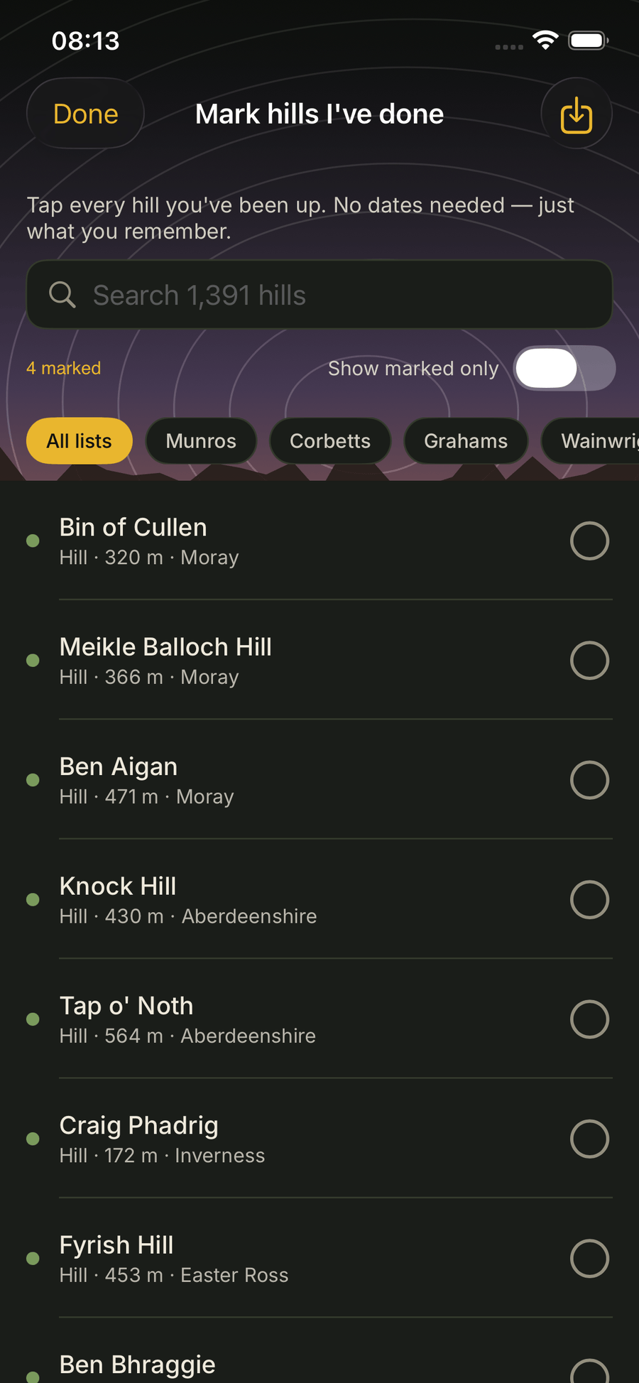
Tick off what you've already done.

If you've been walking a while, tap through the hills you've already done. No dates needed and no GPS trace to invent — your tally and star map fill in straight away. If you kept a spreadsheet you can import it as a CSV instead.

Every summit a gold star

A living map of where you've been.

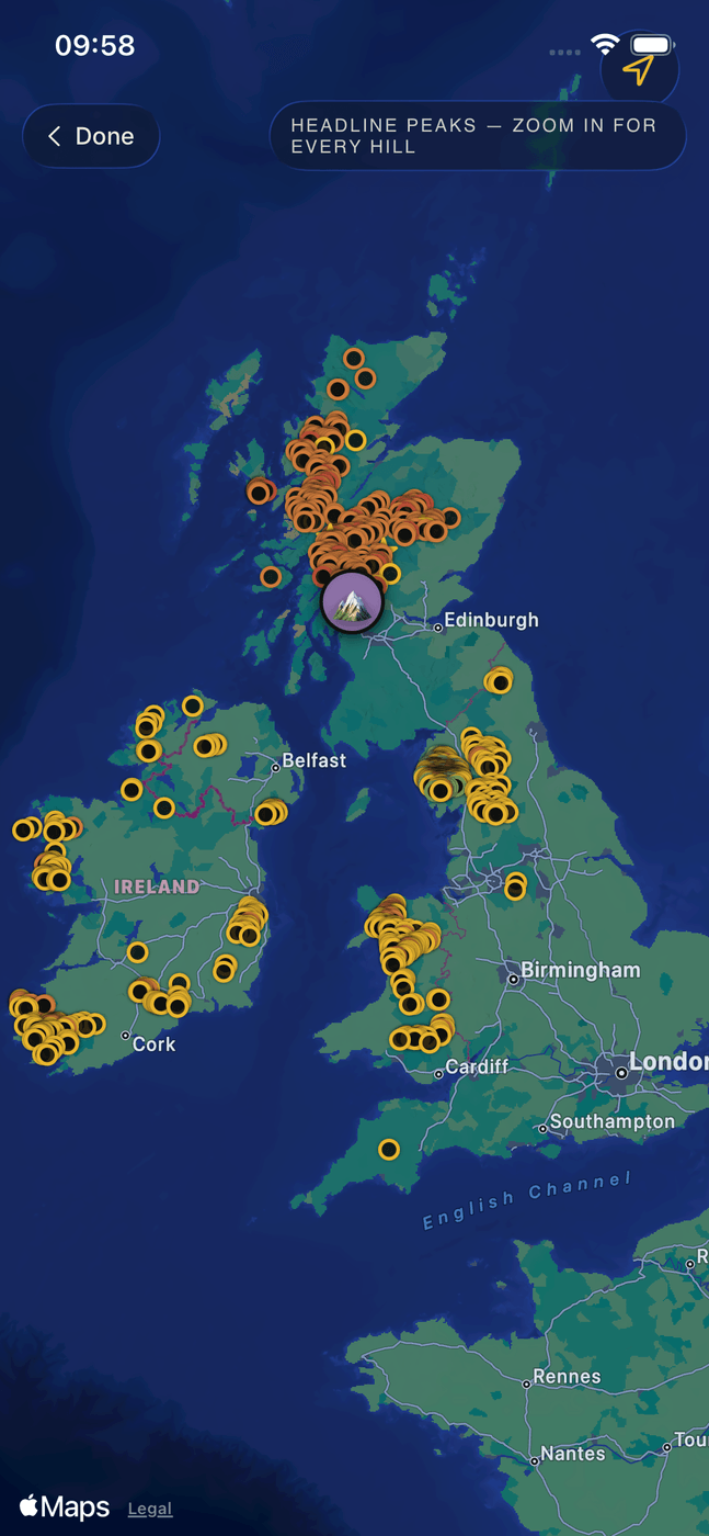
The whole of Britain and Ireland on one terrain map, with hills from the Highlands down to Snowdonia and the Wicklows. Pins are coloured by grade, and the ones you've stood on top of get a gold star, whether you recorded the walk or ticked it off from memory. Zoom in for the smaller hills; zoom out and the bigger ones stay on the map. Your Baggers show at their most recent summit.

Baggers

Walk with your mates, without the group chat.

Add walking mates as Baggers by handle and you'll see each other on the map at your most recent summit. No group chat to keep up with. You can also share a route from a walk you enjoyed, notes and all, so a friend can follow your line up a hill they haven't done.

Map
🏔️ 🥾 🐑
@rachel_hills Last on Ben Wyvis · 2 days ago
Weather warnings

Watch: 55 mph on the summit today.

Opt-in warnings from Apple's forecast on iPhone and Open-Meteo on Android, covering the things that matter on a Scottish hill: summit wind, cloud on the tops, freezing level, and heavy rain in the next few hours. Off by default, on only if you want them.

Bidean nam Bian
Watch: 55 mph on summit
Cloud on the tops · Freezing on summit
Take me there
Private by default

Your walks stay on your phone.

Every walk goes into a private log with the GPS trace, a gold star for the summit and a running tally. No ads and no tracking. You only need to sign in if you want your log synced across devices or you want to use Baggers.

Get the app

That's what's in it.

One payment and it's yours on every hill after that. If you're still not sure which hill to start on, Couch to Corbett picks one for you the first time you open it.

£6.99, once. Not a subscription, and it doesn't expire.

Your walks, mapped

Every summit a gold star.

The app draws your walking history as gold pins across Britain and Ireland, one for every hill you've been up. It fills in gradually over the years.

Safety, quietly built in

The hills can bite. The app helps.

None of this is decoration, and none of it does the thinking for you. It's there to be useful on the day something goes wrong, and quiet the rest of the time.

Tell someone

Text your route to a friend before you leave.

One tap on the hill sheet opens your phone's share sheet — WhatsApp, Messages, whatever you use — with a note already written: what you're climbing, when you set off, when you expect to be back, and the summit grid reference. It takes a couple of seconds.

Weather warnings

55 mph on the summit? Turning back is a skill.

An opt-in summit-weather chip on every hill. It stays quiet when conditions are fine, goes amber above 40 mph or when rain's coming in, and red at 50 mph, which is around where ridge walking gets dangerous. Those are the same thresholds mountain rescue and Mountaineering Scotland use.

SOS

Your grid reference, one tap away.

A red SOS chip sits at the top of the recorder for the whole walk. Tap it and you get your live grid reference, the words to say to mountain rescue, and a Call 999 button. It needs two taps so it can't go off in your pocket.

For an emergency in the UK, dial 999 and ask for the police, then mountain rescue.

The promise

Your walks stay on your phone.

The app carries no adverts, no tracking, no telemetry and no third parties. It works without an account. You'd only sign in if you wanted your log saved across devices or wanted to add walking mates as Baggers.